18 great bike rides in the Narooma - Tilba - Bermagui area of the New South Wales Far South Coast


Ride 3
Forsters Bay to the northern breakwater
Return distance 6 kilometres
Easy grade. Child-friendly
Start: The marinas, Forsters Bay
This short, easy ride is child-friendly. You will be able to enjoy the waterfront ride at a leisurely pace. This ride certainly has plenty of WOW! factor.
Start from the marinas on Forsters Bay. If you are driving to the start of the ride, there is usually plenty of space to park your vehicle.
The first two kilometres are along a well-formed shared path. Just after starting the ride, you will pass the Quota International Sensory Garden—a well-developed facility that garden lovers will appreciate. On your left is Forsters Bay, a quiet waterway for most of the year, but very popular with boating enthusiasts over the main holiday seasons.
The bridge
At the end of the first section of the cycleway is the Princes Highway. Cross the highway, and turn left towards the bridge. There is a footpath and cycleway on the eastern side of the bridge that takes cyclists away from the traffic. From the bridge, there are views across the water. To the east, you can see towards the entrance to Wagonga Inlet, the boats, Mill Bay Boardwalk, and the boatsheds.
Mount Dromedary
To the west, there are uninterrupted views across the water to Mount Dromedary from the bridge and towards the head of the inlet.
Cross over the bridge, and you will see a sealed path going down to the start of the Mill Bay Boardwalk.
Looking at Nature
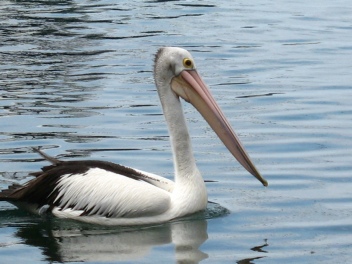
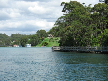
Take your time crossing the boardwalk, as the water is usually very clear, and numerous fish can be seen, including large stingrays. Aquatic birds frequent the shallow waters of this part of the inlet—pelicans, cormorants, egrets, spoonbills amongst them. Take your time also to listen to the bellbirds too, with their metallic-sounding calls. You might be lucky enough to see one of the large white breasted sea eagles—there are a couple whose range includes the trees above the boardwalk.
The SS Lady Darling
At the end of the boardwalk, there are boat launching facilities, picnic tables, and a plaque describing the discovery of the SS Lady Darling, a coal-carrying steamship that sank off Narooma during the late 1800s. The wreck was discovered only during the 1990s by local divers.
Once you leave the boardwalk, look for the concrete shared path. It is just past the boat ramp.
The breakwater
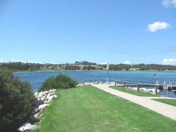
At the end of the shared path, you will see a track that will take you to the end of the northern breakwater. There are patches of soft sand on the track, but most of the track is firm enough to ride.
Near the start of the breakwater, there is a beach that is very popular during the warmer months. There is a ramp going down to the sand if you wish to take your bikes down to the beach while you enjoy a swim, or just to take in the atmosphere while sitting on the sand.
About another two hundred metres further on, you will come to navigation beacons and the end of the breakwater. The rock wall is a good place to sit and take in the views across the water.
Views across to Bar Rock
Across the inlet, you will be able to see wooden stairs going up to Bar Lookout. The rock on the opposite side of the entrance is Australia Rock, names for obvious reasons—features you will be able to visit on another ride.
To the main channel
For now it’s back along the breakwater and past the swimming beach, to pick up the shared pathway. About twenty metres past the steps to the beach, there is a gravel track. That makes a pleasant diversion, as it takes you along the main channel of the inlet. The track is only a few hundred metres long, but is worth riding to the end. Parts of it are gravel, while other sections have been sealed.
Retrace your route over the boardwalk and the bridge to the start of your ride.
Map for Ride 3.


